Bring centimeter-level precision to your infrastructure projects. With our new GPS connector feature for Dalux InfraField, on-site teams can connect the Dalux app with a handheld GPS device, enhancing the accuracy of every registration and piece of field documentation.
This new integration puts the ability to generate as-built data in the hands of your workforce the moment work is completed and instantly shared across the entire project team.
Dalux enables projects to produce highly accurate documentation in a simple, user-friendly way while all work is conducted, by one team, in one workflow, within one solution, InfraField.


A BIM Viewer a leggyorsabb és legjobb módja annak, hogy a BIM modelleket az összes projekttag kezébe juttassa, akár az építési területen.
Köszönjük, hogy regisztrált!
Nyissa meg levelezési postaládáját, hogy hozzáférjen a Dalux projektjéhez és befejezze a regisztrációt!
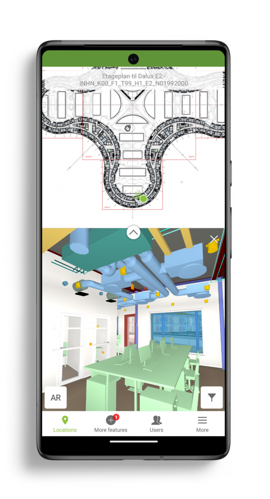
Our BIM Viewer is the fastest and best way to get your BIM models on site and in the hands of all project members.
Thanks for signing up!
Go to your email inbox to access your Dalux project and finish the registration.